Citico Creek and Joyce Kilmer – Slickrock Wilderness Areas, Cherokee National Forest
Citico Creek and Joyce Kilmer – Slickrock Wilderness Areas, Cherokee National Forest
Location:
Citico is on the eastern boundary of Tennessee. Located just north of State
Hwy. 165, it is within 100 miles of Chattanooga, Knoxville, and the Great
Smoky Mountains National Park. Tellico Plains is the closest town at 20 miles
away.
Getting There:
From Knoxville drive south on I-75 to State Hwy. 68. From Chattanooga drive
north on I-75 to the same intersection. Turn east toward Madisonville and
Tellico Plains. From Tellico Plains take State Highway 165, the Cherohala
Skyway, to the southwestern corner of the wilderness, at Warden Fields on
Citico Creek (easiest access), or turn at Double Camp and drive to Farr Gap,
to hike into the Joyce Kilmer-Slickrock Wilderness (stream crossings), or over
Little and Big Foddestack to Citico Wilderness (Nice Ridge top hike). The
Cherohala Skyway skirts the southern edge of the wilderness and provides
access to three major trailheads. You can access it from Grassy Gap and
Rattlesnake Rock (moderate routes). And at the TN/NC State Line and hike
through Jeffries Hell, or over Stratton Bald to Naked Ground through
Slickrock, or hike over Stratton Bald to the Hangover to Big Fat Gap through
the Slickrock Wilderness. The Stratton Bald – Hangover route is the most
scenic ridge top route to access the Joyce Kilmer–Slickrock Wilderness. The
hike from the State line over Stratton Bald to the Hangover and through
Slickrock over Big Fodderstack back to the Citico Wilderness is good 3-day
hike; portions are difficult, not for the inexperienced.
Seasonal Information:
Mid-April to mid-October is the best time to go. Summer ranges are 70 to 80
degrees F. Summer evenings in the mountains can be cool. Fall temperatures are
pleasant in the 70s, with evening lows that may reach 40 degrees F.
Temperatures drop sharply by November and freezing weather often continues until mid-April. Winters average 30 to 40 degrees F. Rain is most likely in late winter and spring, from February to May.
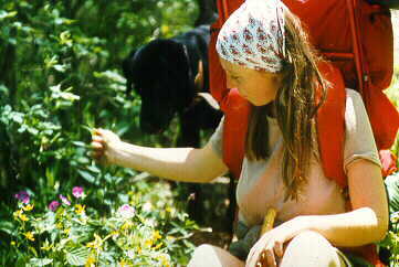
Wildlife:
Black bear, Russian boar, deer, turkey, grouse, squirrel, and raccoon are the
most common species.
In the water, you will find brook, rainbow, and brown trout, small mouth and largemouth bass, and blue catfish.
Insects:
Bees and ticks are usually only a minor problem but may be present.
Plant Life:
Canopied by the large green leaves and splendid blossoms of rosebay
rhododendron, paths will lead you through stands of hemlock and yellow
buckeye.
Spring wildflowers are best from early April to mid-June. Leaf change typically occurs from late September into October.
Facilities:
Camping is primitive in the wilderness. Be warned: The rugged terrain affords
few obvious campsites, and some sections of trail run for long stretches
without a decent place to pitch the smallest of tents.
Outside the wilderness, there are nine developed campgrounds in the Tellico Ranger District. Most of these are open seasonally and provide tables, water, and toilets. Indian Boundary and Double Camp are closest pay sites. Indian Boundary accepts reservations through Biospherics, Inc. at (800) 280-CAMP. The closest free site is at warden’s Field on Citico Creek, along the wilderness’s western boundary.
The Young Branch Horse Camp provides accommodations for up to five nights on Citico Creek in the Tellico Ranger District. Reservations are required. Call for current fees.
Parking:
Motor vehicles are prohibited in the wilderness. Park at the trailheads.
Permits:
Permits aren't required and registration is voluntary.
Policies:
Hazards:
Leave No Trace:
The forest service asks visitors to use camp stoves.
All Leave No Trace guidelines apply.
Maps:
The best map is the combined "Joyce Kilmer-Slickrock Wilderness and
Citico Creek Wilderness" map provided by the Forest Service. The general
map of the Cherokee National Forest is also useful. Both can be obtained for a
small fee by writing the USFS at the above address.
Other Trip Options:
Contact Information:
Cherokee National Forest
Tellico Ranger District
USDA Forest Service
250 Ranger Station Road
Tellico Plains, TN 37385
(423) 253-2520
The Tellico Plains Mountain Press